Kozushima, Japan
Landing Point · JP Japan
1
Connected Cables
JP
Country
34.21°
Latitude
139.14°
Longitude
Ctrl + Scroll to zoom
Connected Cables
| Cable | Status |
|---|---|
| 5 Villages 6 Islands | Active |
Live Performance
25
measurements
9
probes
82
days monitored
265.8
ms avg RTT
0
anomalies
RTT measurements to this landing point from 2026-05-05 through 2026-07-26 - live ICMP round-trip time via our monitoring probes. Recomputed daily. ✓ No anomalies detected in the monitored period.
Measurement sources
| Probe | Location | Samples | Avg |
|---|---|---|---|
| #1014589 own probe | Almaty KZ | 5 | 279.6 ms |
| #1015523 own probe | Moscow RU | 5 | 252.8 ms |
| #6487 own probe | Singapore SG | 3 | 79.7 ms |
| #7062 own probe | Cape Town ZA | 3 | 411.1 ms |
| #6410 own probe | Sao Paulo BR | 2 | 269.1 ms |
| #1014473 own probe | Minsk BY | 2 | 296.5 ms |
| #1014597 own probe | Tbilisi GE | 2 | 282.8 ms |
| #1014969 own probe | Jerusalem IL | 2 | 277.7 ms |
| #1015563 own probe | Saint Petersburg RU | 1 | 258.9 ms |
About Kozushima, Japan
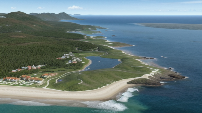
Kozushima: A Small Island Connected to Japan's Submarine Cable Network
Kozushima, a remote island in Japan's Izu archipelago, is home to a single submarine cable landing point. Despite its modest role in Japan's expansive cable infrastructure, Kozushima plays an important part in connecting the smaller islands of the region to the mainland. The cable landing here is part of the "5 Villages 6 Islands" system, a 355-kilometer domestic cable that links Kozushima to eight other landing points, including nearby islands such as Niijima, Mikurashima, and Hachijo.The "5 Villages 6 Islands" Cable
The "5 Villages 6 Islands" cable, operational since 2019, is a domestic system designed to stitch together the Izu Islands, a chain of volcanic islands south of Tokyo. Unlike Japan's larger international cables, which connect the country to global hubs, this cable focuses entirely on regional connectivity. Kozushima is one of nine landing points in this chain, ensuring that even smaller, less populated islands have access to reliable telecommunications. This regional cable is critical for maintaining communication between the islands and the mainland, supporting local communities, tourism, and small-scale industries. While Kozushima itself does not host major industrial or research facilities, its inclusion in the cable network ensures that residents and businesses can access the same digital services as those on larger islands or the mainland.Regional Context: Kozushima's Role in Japan's Cable Network
Japan is a global leader in submarine cable infrastructure, with 51 cables landing at 68 points across the country. Compared to major landing points like Shima (12 cables) or Maruyama (9 cables), Kozushima's single cable may seem modest. However, its role is specialized: it serves as a link in a domestic chain that prioritizes regional connectivity over international reach. This focus on local connections contrasts sharply with landing points like Chikura, which hosts eight cables, many of them international systems connecting Japan to the United States and other countries. Kozushima's cable, by comparison, does not extend beyond Japan's borders, emphasizing its role in supporting the Izu Islands rather than global telecommunications.Latency Measurements: Kozushima's Performance
GeoCables has conducted 21 latency checks to Kozushima from nine source cities, with an average round-trip latency of 264 milliseconds. The best observed latency was 80 milliseconds, a solid performance for a remote island connected by a regional cable system. These measurements highlight the efficiency of the "5 Villages 6 Islands" cable in maintaining connectivity across the Izu Islands.Conclusion
Kozushima may not stand out in Japan's vast submarine cable network, but its connection via the "5 Villages 6 Islands" cable is essential for regional integration. As one link in a chain that ties together the Izu Islands, Kozushima ensures that even smaller communities remain connected to the digital world. For residents and visitors alike, this single cable provides access to the services and communications that modern life depends on, bridging the gap between island life and mainland Japan.What next: Kozushima, Japan in the global directory of cable landing points; see surrounding routes on the interactive submarine cable map or follow live network monitoring.
Other Landing Points in Japan
JP Aguni, Japan
26.5872°N 127.2290°E
JP Ajigaura, Japan
36.3836°N 140.6123°E
JP Akita, Japan
39.7167°N 140.1167°E
JP Ama, Japan
26.2310°N 127.2923°E
JP Aogashima, Japan
32.4572°N 139.7656°E
JP Awashimaura, Japan
38.4646°N 139.2528°E
JP Chichijima, Japan
27.0665°N 142.2041°E
JP Chikura, Japan
34.9767°N 139.9547°E
JP Emi, Japan
35.0624°N 140.0611°E
JP Fukuoka, Japan
33.5904°N 130.4017°E
JP Gusukube, Japan
24.7515°N 125.3873°E
JP Hachijo, Japan
33.1123°N 139.7968°E
FAQ
Landing Point
- CountryJP Japan
- Coordinates34.2070°N 139.1396°E
- Connected Cables1
See Real Cable Routes
View actual submarine cable routing from Kozushima, Japan - with backbone nodes, distance calculations, and latency estimates
Open Calculator →
Submarine cables
🛤 Land fiber
Live probes