Madang, Papua New Guinea
Landing Point · PG Papua New Guinea
Connected Cables
| Cable | Status |
|---|---|
| Kumul Domestic Submarine Cable System | Active |
| PIPE Pacific Cable-1 (PPC-1) | Active |
Live Performance
RTT measurements to this landing point from 2026-03-03 through 2026-07-18 - live ICMP round-trip time via our monitoring probes. Recomputed daily. ✓ No anomalies detected in the monitored period.
Measurement sources
| Probe | Location | Samples | Avg |
|---|---|---|---|
| #1014473 own probe | Minsk BY | 6 | 189.0 ms |
| #1014589 own probe | Almaty KZ | 6 | 213.4 ms |
| #1014597 own probe | Tbilisi GE | 6 | 220.3 ms |
| #6410 own probe | Sao Paulo BR | 5 | 359.8 ms |
| #6427 own probe | Sydney AU | 5 | 114.3 ms |
| #6487 own probe | Singapore SG | 5 | 145.7 ms |
| #1014969 own probe | Jerusalem IL | 5 | 246.4 ms |
| #1015313 own probe | Sevastopol UA | 2 | 174.0 ms |
| #1015523 own probe | Moscow RU | 2 | 157.7 ms |
| #7062 own probe | Cape Town ZA | 1 | 315.9 ms |
| #50365 | control probe | 1 | 384.1 ms |
About Madang, Papua New Guinea
Position in regional infrastructure
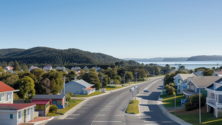
Madang sits on the north coast of Papua New Guinea at coordinates 5.233685°S, 145.784761°E, the capital of Madang Province and a town of approximately 27,000 people. For submarine cable infrastructure, Madang holds a specific structural role: it is one of the small number of Papua New Guinean coastal communities where international long-haul fibre meets the country's domestic submarine network. Two cables land here — one a regional spine connecting fifteen PNG coastal towns into a single national submarine ring, the other a long-haul link reaching Sydney via Guam.
This combination of one domestic ring cable and one international cable is what makes Madang functionally significant beyond its modest population: a fault on either system has cascading effects. If the domestic ring is interrupted, traffic still reaches Madang from the international link but cannot redistribute east or west along PNG's coast. If the international link fails, Madang and connected PNG communities lose direct fibre access to Australasia.
Submarine cables landing in Madang
Kumul Domestic Submarine Cable System is a 5,457 km submarine cable system in service since 2019, owned and operated by PNG DataCo Limited. From Madang it connects to fourteen other Papua New Guinean coastal towns — including Lae, Port Moresby, Wewak, Vanimo, and ten more — plus an extension to Jayapura in Indonesian Papua. Kumul was the first major PNG-government-funded national submarine cable, designed to give domestic broadband access to provincial centres that had no terrestrial fibre alternatives across PNG's mountainous interior.
PIPE Pacific Cable-1 (PPC-1) is a 6,900 km submarine cable in service since 2009, owned by Vocus Communications. From Madang it provides long-haul international connectivity, reaching Piti in Guam (a Pacific cable hub) and continuing to Sydney, Australia. PPC-1 was Australia's second major trans-Pacific submarine cable when commissioned and gave PNG its first direct fibre connection to the Australian mainland through a single cable hop.
Connection topology and redundancy
The two cables at Madang are functionally distinct rather than redundant. Kumul moves traffic horizontally along PNG's coast and across to Indonesia; PPC-1 moves traffic vertically out of PNG to Sydney via Guam. There is no second international cable at Madang, so the city has only one path to international internet exchanges; if PPC-1 fails, alternative routing for PNG traffic must come through Port Moresby or via the Kumul extension into Indonesian fibre at Jayapura.
The single-international-cable topology makes PPC-1 a critical asset for Madang and for PNG's wider connectivity. It is owned by a single operator (Vocus), in contrast to many international cables which use consortium ownership for shared risk. The Kumul ring's fifteen-landing topology gives strong domestic redundancy: a fault between any two adjacent landings still allows traffic to take the other direction around the ring to reach its destination.
Geography and coordinates
The Madang submarine cable landing sits at 5.233685°S, 145.784761°E (5°14'01"S, 145°47'05"E) on the north coast of Papua New Guinea, within Madang Province. The coastal town faces the Bismarck Sea and provides protected harbour access — Madang is one of the largest natural harbours in the South Pacific, which historically made it a maritime hub long before fibre-optic infrastructure.
Frequently asked questions
What submarine cables land at Madang, Papua New Guinea?
Two submarine cables land at Madang: Kumul Domestic Submarine Cable System (PNG-wide ring + Indonesia, RFS 2019) and PIPE Pacific Cable-1 PPC-1 (long-haul to Sydney via Guam, RFS 2009).
What are the coordinates of the Madang cable landing?
The Madang cable landing is at 5.233685°S, 145.784761°E (5°14'01"S, 145°47'05"E), on the north coast of Papua New Guinea facing the Bismarck Sea.
Which countries connect to Papua New Guinea through Madang?
Through PPC-1, Madang reaches Guam and Australia (Sydney) — providing PNG's main direct fibre connection to Australasia. Through Kumul, Madang reaches Indonesia (Jayapura) and 14 other PNG coastal communities, integrating Madang into the country's national submarine ring.
When was the first submarine cable laid at Madang?
The earliest cable at Madang in the GeoCables dataset is PPC-1, in service since 2009. Kumul followed in 2019 as PNG's first government-funded national submarine ring, dramatically expanding domestic broadband reach.
Who operates the cables landing at Madang?
Kumul is owned and operated by PNG DataCo Limited (a state-aligned PNG operator). PPC-1 is owned by Vocus Communications, an Australian operator.
What next: Madang, Papua New Guinea in the global directory of cable landing points; see surrounding routes on the interactive submarine cable map or follow live network monitoring.
Other Landing Points in Papua New Guinea
FAQ
Landing Point
- CountryPG Papua New Guinea
- Coordinates5.2337°S 145.7848°E
- Connected Cables2
See Real Cable Routes
View actual submarine cable routing from Madang, Papua New Guinea - with backbone nodes, distance calculations, and latency estimates
Open Calculator →