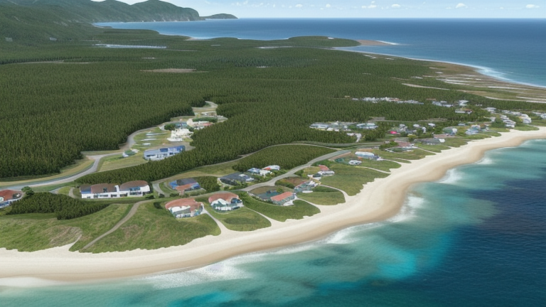
Keawaula, HI, United States
Landing Point · US United States
Connected Cables
| Cable | Status |
|---|---|
| Asia-America Gateway (AAG) Cable System | Active |
| Telstra Endeavour | Active |
📡 Live Performance
RTT measurements to this landing point from 2026-04-12 through 2026-06-23 - live ICMP round-trip time via our monitoring probes. Recomputed daily. ✓ No anomalies detected in the monitored period.
Measurement sources
| Probe | Location | Samples | Avg |
|---|---|---|---|
| #1318 | control probe | 25 | 290.8 ms |
| #6427 own probe | Sydney AU | 4 | 193.2 ms |
| #6487 own probe | Singapore SG | 4 | 227.0 ms |
| #7062 own probe | Cape Town ZA | 4 | 326.5 ms |
| #1014473 own probe | Minsk BY | 2 | 204.9 ms |
| #1014589 own probe | Almaty KZ | 2 | 194.2 ms |
| #1014597 own probe | Tbilisi GE | 2 | 171.4 ms |
| #1014969 own probe | Jerusalem IL | 2 | 160.5 ms |
| #1015523 own probe | Moscow RU | 2 | 133.1 ms |
| #1015313 own probe | Sevastopol UA | 1 | 182.2 ms |
About Keawaula, HI, United States
Keawaula, HI, United States: Submarine Cable Landing Point
Keawaula is a coastal landing point located on the island of Oahu, Hawaii, United States. As a Hawaiian landing point, it sits at a geographic crossroads between the continental United States and the Asia-Pacific region, making it a natural terminus for transpacific submarine cable systems. Two submarine cables land at Keawaula, connecting the United States to a broad set of countries across Southeast Asia, East Asia, and the South Pacific.
The two cables landing here — the Asia-America Gateway (AAG) Cable System and Telstra Endeavour — together extend the reach of this landing point across two distinct transpacific corridors. The AAG system connects Keawaula to multiple Southeast and East Asian nations, while Telstra Endeavour provides a direct link between Hawaii and Australia. Together, these cables establish Keawaula as a node within both the broader Asia-Pacific submarine cable network and the Australia–United States corridor.
Cables Landing at Keawaula, HI, United States
The Asia-America Gateway (AAG) Cable System is a 20,000 km submarine cable that reached ready-for-service status in 2009. In addition to Keawaula, it connects Brunei, China, Guam, Malaysia, the Philippines, and Singapore, forming a wide transpacific link between Southeast Asia, East Asia, and the United States. Its extensive reach across multiple Southeast Asian nations makes it one of the longer systems landing at this point.
The Telstra Endeavour cable spans 9,125 km and entered service in 2008. It connects Keawaula directly to Australia, establishing a dedicated transpacific link between Hawaii and the Australian continent. As a bilateral system, it provides a more focused connectivity corridor between the United States and Australia compared to the multi-country AAG network.
Regional Context
Within the United States, Keawaula hosts 2 submarine cables, placing it among the smaller landing points in a national infrastructure that spans 113 cables across 160 landing points. Among its regional peers, Kapolei — also on Hawaii — hosts 5 cables, while larger hubs such as Boca Raton, FL and San Juan, PR each serve 8 cables. Keawaula's profile is more specialized, reflecting Hawaii's role as a transpacific waypoint rather than a broad multi-corridor hub.
Network Role
Keawaula functions as a dual-cable terminus serving two distinct transpacific routes: one oriented toward Southeast and East Asia via the AAG system, and another directed toward Australia via Telstra Endeavour. This combination means the landing point supports connectivity across a wide geographic arc spanning from Singapore and China in the west to Australia in the south. Rather than a high-volume multi-cable hub, Keawaula represents a focused transpacific node with two well-established long-haul systems.
Within the broader submarine cable graph of the United States, Keawaula occupies a position that reflects Hawaii's distinct geographic value as a mid-Pacific landing location. Its two cables collectively serve seven countries beyond the United States, giving it an international reach that exceeds what its cable count alone might suggest.
What next: Keawaula, HI, United States in the global directory of cable landing points; see surrounding routes on the interactive submarine cable map or follow live network monitoring.
Other Landing Points in United States
FAQ
Landing Point
- CountryUS United States
- Coordinates21.5488°N 158.2420°W
- Connected Cables2
See Real Cable Routes
View actual submarine cable routing from Keawaula, HI, United States - with backbone nodes, distance calculations, and latency estimates
Open Calculator →