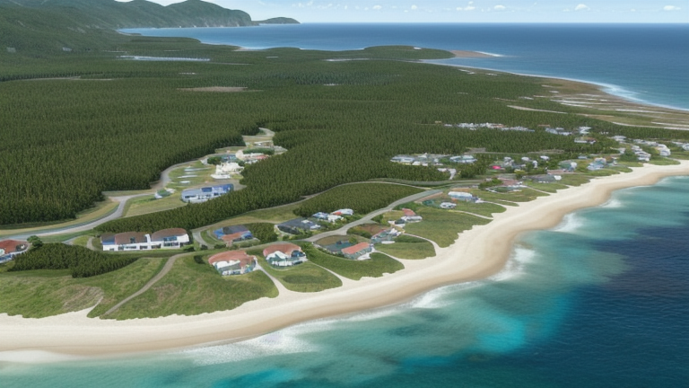
Kapolei, HI, United States
Landing Point · US United States
Connected Cables
| Cable | Status |
|---|---|
| APX East | Planned |
| Bulikula | Active |
| Hawaiki | Active |
| Tabua | Active |
| Taihei | Planned |
📡 Live Performance
RTT measurements to this landing point from 2026-04-10 through 2026-07-22 - live ICMP round-trip time via our monitoring probes. Recomputed daily. ✓ No anomalies detected in the monitored period.
Measurement sources
| Probe | Location | Samples | Avg |
|---|---|---|---|
| #61129 | control probe | 287 | 160.6 ms |
| #50604 | control probe | 159 | 164.8 ms |
| #7531 | control probe | 129 | 180.8 ms |
| #55079 | control probe | 78 | 208.5 ms |
| #583 | control probe | 49 | 164.3 ms |
| #17855 | control probe | 43 | 277.5 ms |
| #22322 | control probe | 31 | 168.1 ms |
| #11522 | control probe | 21 | 193.0 ms |
| #12496 | control probe | 15 | 204.4 ms |
| #6427 own probe | Sydney AU | 2 | 204.7 ms |
| #6487 own probe | Singapore SG | 2 | 224.3 ms |
| #7062 own probe | Cape Town ZA | 2 | 294.8 ms |
| #1013932 | control probe | 2 | 145.3 ms |
About Kapolei, HI, United States
Kapolei, HI, United States is a submarine cable landing point in United States (coordinates 21.3354°, -158.0569°). It serves 5 submarine cable systems, making it a significant node in United States's international connectivity infrastructure.
Kapolei is a planned community in the City and County of Honolulu, Hawaiʻi, United States, on the island of Oʻahu. In 1977, the government designated it as the "second city" of Oʻahu, in relation to Honolulu. For statistical purposes, the United States Census Bureau has defined Kapolei as a census-designated place (CDP) within the consolidated city-county of Honolulu. As of the 2020 census, Kapolei had a population of 21,411. Wikipedia
Connected submarine cables
| Cable | RFS | Length | Owners |
|---|---|---|---|
| APX East | 2028 | 13,000 km | SUBCO |
| Taihei | 2027 | 7,000 km | |
| Bulikula | 2026 | 21,600 km | |
| Tabua | 2026 | -1 km | |
| Hawaiki | 2018 | 14,000 km | BW Digital |
Operators landing at Kapolei, HI, United States
Cables landing at Kapolei, HI, United States are operated by 3 distinct consortium partners and carriers, including BW Digital, Google, SUBCO. Each cable is typically jointly owned by a consortium of tier-one carriers and hyperscale operators who share construction costs and capacity; the operator mix reflects both regional incumbents and global players with interest in the routes served by this landing point.
Connectivity profile
From Kapolei, HI, United States, international traffic can reach 10 countries through 5 cable systems. Destinations include American Samoa, Australia, Fiji, French Polynesia, Guam, Japan, New Zealand, Northern Mariana Islands and 2 more. With multiple redundant paths, traffic at this landing point can reroute through alternative cables if any single system experiences an outage.
Monitoring status
No monitoring incidents were recorded on cables serving Kapolei, HI, United States in the past 90 days — all connected systems remained within normal latency thresholds. Our monitoring network continuously samples latency from external probes to targets reachable via these cables.
About the cables
- APX East (2028) — APX East is a cross-regional submarine cable connecting United States, Fiji, Australia. Its 4 landing points at Kapolei, San Diego, Suva, Sydney bridge the networks of North America, Oceania, providing an important path for international data traffic. Read more →
- Taihei (2027) — Taihei is a point-to-point submarine cable linking United States and Japan. Landing at Kapolei, Takahagi, it provides a direct fiber-optic path between the two countries, serving as both a primary data route and a redundancy option for neighboring cable systems. Read more →
- Bulikula (2026) — Bulikula is a 21,600 km submarine cable system lit for service in 2026, connecting a geographically scattered set of Pacific landings: Kapolei in Hawaii, Piti and Tinian in the Mariana Islands, Natadola and Suva in Fiji, and Faratea, Papenoo, and Mitirapa in French Polynesia. Read more →
- Tabua (2026) — Tabua is a cross-regional submarine cable connecting United States, Australia, Fiji. Its 6 landing points at Kapolei, Los Angeles, Maroochydore, Natadola, Suva, and 1 more bridge the networks of North America, Oceania, providing an important path for international data traffic. Read more →
- Hawaiki (2018) — Hawaiki is a cross-regional submarine cable connecting United States, New Zealand, Tonga, American Samoa, Australia. Its 6 landing points at Hillsboro, Kapolei, Mangawhai, Neiafu, Pago Pago, and 1 more bridge the networks of North America, Oceania, providing an important path for international data traffic. Read more →
What next: Kapolei, HI, United States in the global directory of cable landing points; see surrounding routes on the interactive submarine cable map or follow live network monitoring.
Other Landing Points in United States
FAQ
Landing Point
- CountryUS United States
- Coordinates21.3354°N 158.0569°W
- Connected Cables5
See Real Cable Routes
View actual submarine cable routing from Kapolei, HI, United States - with backbone nodes, distance calculations, and latency estimates
Open Calculator →