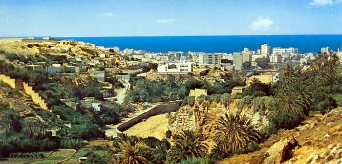
Derna, Libya
Landing Point · LY Libya
Connected Cables
| Cable | Status |
|---|---|
| LFON (Libyan Fiber Optic Network) | Active |
| Silphium | Active |
📡 Live Performance
RTT measurements to this landing point from 2026-03-07 through 2026-07-22 - live ICMP round-trip time via our monitoring probes. Recomputed daily.
Measurement sources
| Probe | Location | Samples | Avg |
|---|---|---|---|
| #11522 | control probe | 174 | 160.1 ms |
| #1014473 own probe | Minsk BY | 5 | 244.1 ms |
| #1014589 own probe | Almaty KZ | 5 | 167.8 ms |
| #1014597 own probe | Tbilisi GE | 5 | 151.3 ms |
| #1014969 own probe | Jerusalem IL | 5 | 141.8 ms |
| #1015313 own probe | Sevastopol UA | 2 | 295.7 ms |
| #1015523 own probe | Moscow RU | 2 | 239.3 ms |
| #6410 own probe | Sao Paulo BR | 1 | 138.7 ms |
| #6427 own probe | Sydney AU | 1 | 198.8 ms |
| #33920 | control probe | 1 | 145.3 ms |
| #1015932 own probe | Odessa UA | 1 | 146.3 ms |
| #1015984 own probe | Balancer IL | 1 | 133.8 ms |
About Derna, Libya
Derna, Libya: Submarine Cable Landing Point
Derna is a port city on the northeastern coast of Libya, situated along the Mediterranean Sea between the Jebel Akhdar range and the surrounding desert. As a coastal city in the Cyrenaica region of eastern Libya, Derna has developed into a landing point for submarine cable infrastructure connecting the country to both domestic and international networks. Two submarine cables land at Derna: the LFON (Libyan Fiber Optic Network) and Silphium.
Together, these two cables position Derna within two distinct corridors. The LFON cable connects multiple landing points within Libya itself, forming a domestic coastal network along the Libyan shoreline. The Silphium cable extends Derna's reach northward across the Mediterranean to Greece, enabling direct connectivity between northeastern Libya and southern Europe. This combination gives Derna both an intra-Libyan and a cross-Mediterranean function within the country's submarine cable geography.
Cables Landing at Derna
LFON (Libyan Fiber Optic Network) is a submarine cable measuring 1,639 km in length, with a ready-for-service date of 1999. The cable connects multiple landing points within Libya, running along the country's Mediterranean coastline as a domestic fiber optic route. Derna is one of the Libyan cities served by this network, which links Libya's coastal communities without extending to any foreign country.
Silphium is a submarine cable measuring 425 km in length, with a ready-for-service date of 2013. The cable connects Derna, Libya, to Greece, crossing the eastern Mediterranean and establishing a direct link between Libya's Cyrenaica coast and the European telecommunications network via Greece. Silphium is notably shorter than the average submarine cable landing in Libya, reflecting the relatively modest geographic distance between northeastern Libya and the Greek coastline.
Regional Context
Within Libya's submarine cable landscape, Derna ranks alongside Benghazi, Misuratah, and Tobruk as a landing point hosting two cables, placing it above Al Bayda and Al Khums, which each serve a single cable, while Tripoli leads the country with three cables. Derna's position in eastern Libya makes it a complement to the more heavily connected western hub at Tripoli, serving the Cyrenaica region alongside its neighbors Benghazi and Tobruk.
Network Role
Derna functions as a two-cable landing point, distinguishing it from single-cable sites elsewhere in Libya while remaining below the connectivity level of Tripoli. The LFON cable integrates Derna into Libya's domestic coastal network, while Silphium provides the city's only direct international connection, linking it to Greece and, through that route, to the broader European telecommunications infrastructure. Together, these cables mean that Derna serves both intra-national and cross-Mediterranean routing functions from a single landing point on the Cyrenaica coast.
In the wider submarine cable graph of Libya and the eastern Mediterranean, Derna represents one of the key eastern Libyan access nodes for European connectivity, particularly through the Silphium route to Greece. Its dual cable presence reinforces the geographic distribution of Libya's submarine cable infrastructure across both the western and eastern sections of the country's Mediterranean coastline.
What next: Derna, Libya in the global directory of cable landing points; see surrounding routes on the interactive submarine cable map or follow live network monitoring.
Other Landing Points in Libya
FAQ
Landing Point
- CountryLY Libya
- Coordinates32.7636°N 22.6392°E
- Connected Cables2
See Real Cable Routes
View actual submarine cable routing from Derna, Libya - with backbone nodes, distance calculations, and latency estimates
Open Calculator →