Ardmair, United Kingdom
Landing Point · GB United Kingdom
1
Connected Cables
GB
Country
57.93°
Latitude
5.20°
Longitude
Ctrl + Scroll to zoom
Connected Cables
| Cable | Status |
|---|---|
| BT Highlands and Islands Submarine Cable System | Active |
Live Performance
17
measurements
7
probes
4
days monitored
104.2
ms avg RTT
0
anomalies
RTT measurements to this landing point from 2026-07-15 through 2026-07-19 - live ICMP round-trip time via our monitoring probes. Recomputed daily. ✓ No anomalies detected in the monitored period.
Measurement sources
| Probe | Location | Samples | Avg |
|---|---|---|---|
| #6427 own probe | Sydney AU | 3 | 250.1 ms |
| #6487 own probe | Singapore SG | 3 | 165.5 ms |
| #1014473 own probe | Minsk BY | 3 | 37.8 ms |
| #1016031 own probe | Kyiv UA | 3 | 45.5 ms |
| #1015523 own probe | Moscow RU | 2 | 66.1 ms |
| #1015932 own probe | Odessa UA | 2 | 49.5 ms |
| #1015563 own probe | Saint Petersburg RU | 1 | 43.5 ms |
About Ardmair, United Kingdom
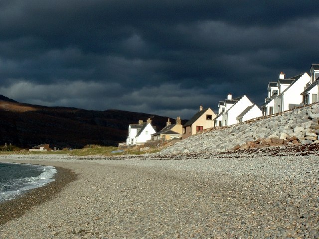
Ardmair: A Remote Link in the Highlands
Ardmair, a small village nestled in the rugged beauty of the North West Highlands of Scotland, serves as one of the landing points for the BT Highlands and Islands Submarine Cable System. While Ardmair may not boast the dense connectivity of larger hubs like Bude or Lowestoft, its single cable plays a unique role in stitching together the scattered communities of this remote region.The BT Highlands and Islands Submarine Cable System
The cable landing at Ardmair is part of the BT Highlands and Islands Submarine Cable System, which spans 402 km and became operational in 2014. This domestic cable connects 40 landing points across the United Kingdom, including other remote locations such as Calgary, Ardgour, and Branahuie Bay. Unlike international hubs such as Bude, which hosts eight cables linking to multiple countries, Ardmair’s cable is entirely domestic, focusing on regional connectivity within the United Kingdom. This network is essential for the Highlands and Islands, an area characterized by its sparse population and challenging geography. The cable enables reliable communication and data transfer between isolated communities, supporting local businesses, tourism, and daily life in places where terrestrial infrastructure would be difficult or costly to maintain.Connectivity in Context
Ardmair’s single cable places it among the quieter landing points in the United Kingdom, where 125 locations host a total of 66 submarine cables. With an average cable length of 1615 km across the country, the BT Highlands and Islands system is relatively short, designed specifically to serve the needs of Scotland’s coastal and island communities. GeoCables’ latency measurements reveal that connectivity from Ardmair is consistent and efficient, with an average round-trip latency of 102 ms and a best-observed latency of 36 ms. These numbers reflect the cable’s role in providing reliable service to the region, even in its remote setting.A Village with a View
Beyond its role in digital connectivity, Ardmair is a picturesque village known for its holiday homes, caravan site, and access to outdoor activities. Visitors often explore the nearby peak of Ben Mor Coigach or hire boats from the beach, enjoying the natural beauty of the Highlands. While its former identity as a fishing village has evolved, Ardmair remains a place where the rhythms of nature and human activity coexist. The presence of the submarine cable here underscores the importance of connecting even the most remote corners of the United Kingdom. For Ardmair, this single link is not about global reach but about ensuring that the Highlands remain part of the national conversation, both digitally and economically.What next: Ardmair, United Kingdom in the global directory of cable landing points; see surrounding routes on the interactive submarine cable map or follow live network monitoring.
Other Landing Points in United Kingdom
GB Aberdeen, United Kingdom
57.1538°N 2.1068°W
GB Achnaba, United Kingdom
56.0194°N 5.3658°W
GB Aikerness Bay, United Kingdom
59.1180°N 3.0951°W
GB Aldeburgh, United Kingdom
52.1578°N 1.5906°E
GB Ardbeg Point, United Kingdom
55.8586°N 5.0636°W
GB Ardgour, United Kingdom
56.7216°N 5.2337°W
GB Ardnacross, United Kingdom
55.4765°N 5.5334°W
GB Ardneil Bay, United Kingdom
55.6930°N 4.8894°W
GB Ardvasar, United Kingdom
57.0594°N 5.9065°W
GB Ardyne Point, United Kingdom
55.8694°N 5.0200°W
GB Ayre of Cara, United Kingdom
58.8333°N 2.9001°W
GB Baile Mòr, United Kingdom
56.3290°N 6.3947°W
Landing Point
- CountryGB United Kingdom
- Coordinates57.9341°N 5.1962°W
- Connected Cables1
See Real Cable Routes
View actual submarine cable routing from Ardmair, United Kingdom - with backbone nodes, distance calculations, and latency estimates
Open Calculator →
Submarine cables
🛤 Land fiber
Live probes