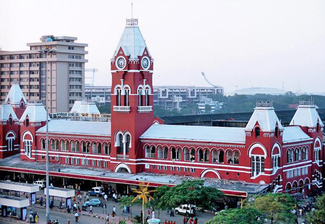
Chennai, India
Landing Point · IN India
Connected Cables
| Cable | Status |
|---|---|
| Bay of Bengal Gateway (BBG) | Active |
| Chennai-Andaman & Nicobar Islands Cable (CANI) | Active |
| i2i Cable Network (i2icn) | Active |
| India Asia Xpress (IAX) | Active |
| MIST | Active |
| Project Waterworth | Planned |
| SeaMeWe-4 | Active |
| SeaMeWe-6 | Active |
| Tata TGN-Tata Indicom | Active |
📡 Live Performance
RTT measurements to this landing point from 2026-03-07 through 2026-07-23 - live ICMP round-trip time via our monitoring probes. Recomputed daily.
Measurement sources
| Probe | Location | Samples | Avg |
|---|---|---|---|
| #4429 | control probe | 139 | 94.7 ms |
| #1033 | control probe | 46 | 83.8 ms |
| #1014589 own probe | Almaty KZ | 18 | 244.7 ms |
| #6410 own probe | Sao Paulo BR | 13 | 341.8 ms |
| #6487 own probe | Singapore SG | 13 | 68.2 ms |
| #1014597 own probe | Tbilisi GE | 8 | 227.2 ms |
| #1014473 own probe | Minsk BY | 6 | 198.0 ms |
| #1014969 own probe | Jerusalem IL | 4 | 244.8 ms |
| #6427 own probe | Sydney AU | 2 | 164.8 ms |
| #6477 | control probe | 1 | 40.0 ms |
About Chennai, India
Position in regional infrastructure
Chennai is the capital of Tamil Nadu and India's principal east coast submarine cable landing point, at coordinates 13.063485°N, 80.243084°E on the Bay of Bengal. The city is one of three major Indian submarine cable hubs — alongside Mumbai (Arabian Sea coast) and Cochin/Tuticorin further south — and serves as the Indian gateway facing Southeast Asia and East Asia. Several major cables land at Chennai connecting India to Singapore, Malaysia, Thailand, Indonesia, Sri Lanka, Maldives, and other regional landings.
Chennai's role is structurally distinct from Mumbai: Mumbai cables predominantly route to the Middle East and Europe via the Suez/Red Sea corridor, while Chennai cables route eastward to Southeast Asia. This east/west specialisation gives India geographic redundancy at the national scale — a fault affecting Mumbai's western Arabian Sea cables does not directly affect Chennai's eastern Bay of Bengal cables.
Submarine cables landing in Chennai
Project Waterworth is a 50,000 km Meta-built submarine cable system planned for ready-for-service. From Chennai it reaches Australia (Darwin), Brazil (Fortaleza), India (Mumbai), Malaysia (Penang), South Africa (Amanzimtoti, Cape Town), and the United States (Los Angeles, Myrtle Beach). Waterworth is one of the longest cables in development globally.
SeaMeWe-6 is a 21,700 km submarine cable scheduled for ready-for-service in 2026, owned by a 16-member consortium including Microsoft. From Chennai it reaches Bahrain, Bangladesh, Djibouti, Egypt, France (Marseille), India (Mumbai), Maldives, Malaysia, Oman, Pakistan, Qatar, Saudi Arabia, Singapore, Sri Lanka, UAE.
India-Asia Xpress (IAX) is a 5,791 km submarine cable in service since 2024, owned by China Mobile and Reliance Jio. From Chennai it reaches India (Digha, Machilipatnam, Mumbai), Malaysia (Morib), Maldives, Singapore (Tuas), Sri Lanka, Thailand.
MIST is an 8,100 km submarine cable in service since 2024, owned by Orient Link. From Chennai it reaches Mumbai, Malaysia, Singapore, Thailand.
Bay of Bengal Gateway (BBG) is an 8,100 km submarine cable in service since 2016. From Chennai it reaches Mumbai, Malaysia, Oman, Sri Lanka, UAE.
SeaMeWe-4 is a 20,000 km submarine cable in service since 2005. From Chennai it reaches a 16-country path including France, Egypt, Saudi Arabia, UAE, Pakistan, Bangladesh, Singapore, Malaysia, Thailand.
Chennai-Andaman & Nicobar Islands Cable (CANI) is a 2,300 km submarine cable in service since 2020, owned by BSNL. Domestic Indian cable connecting Chennai to seven landings in Andaman and Nicobar Islands (Sri Vijaya Puram, Havelock, Long Island, Rangat, Kamorta, Little Andaman, Car Nicobar, Great Nicobar).
i2i Cable Network (i2icn) is a 3,200 km submarine cable in service since 2002, owned by Bharti Airtel. From Chennai it reaches Tuas (Singapore) — one of the early India-Singapore direct fibre links.
Tata TGN-Tata Indicom is a 3,175 km submarine cable in service since 2004, owned by Tata Communications. From Chennai it reaches Changi North (Singapore).
Connection topology and redundancy
Chennai's portfolio gives India strong redundancy for Southeast Asian connectivity: multiple cables (BBG, IAX, MIST, SeaMeWe-4) reach Singapore through different routes; multiple cables also reach Malaysia, Sri Lanka and UAE. The mix of consortium-owned (SeaMeWe-4/6, BBG) and single-operator cables (IAX from Reliance Jio + China Mobile, MIST from Orient Link, Bharti Airtel's i2icn) provides operator-level diversity beyond simple cable count.
The CANI domestic cable to Andaman and Nicobar is a specific national infrastructure asset — without it, the Indian Union Territory of Andaman and Nicobar Islands would depend entirely on satellite connectivity. The 2024 deployment of IAX and MIST (both new modern cables to Singapore) reflects continued investment in Chennai's eastward fibre capacity, supporting India's growing data centre footprint in Tamil Nadu and Karnataka.
Geography and coordinates
The Chennai submarine cable landing sits at 13.063485°N, 80.243084°E (13°03'48"N, 80°14'35"E), on the Coromandel Coast of Tamil Nadu in southeastern India. Chennai's Bay of Bengal facing position provides direct cable approach corridors eastward toward Southeast Asia without intervening Indian peninsular shadowing.
Frequently asked questions
What submarine cables land at Chennai, India?
Many cables land at Chennai including Bay of Bengal Gateway (BBG, 2016), India-Asia Xpress (IAX, 2024), MIST (2024), SeaMeWe-4 (2005), CANI (2020), i2icn (2002), Tata TGN-Tata Indicom (2004). Planned: SeaMeWe-6 (2026), Project Waterworth (Meta).
What are the coordinates of the Chennai cable landing?
Chennai cable landing is at 13.063485°N, 80.243084°E (13°03'48"N, 80°14'35"E), on the Coromandel Coast of Tamil Nadu, southeastern India.
Which countries connect to India through Chennai?
Through Chennai's cables, India reaches Singapore, Malaysia, Thailand, Indonesia (planned), Sri Lanka, Maldives, Bangladesh, UAE, Oman, Saudi Arabia, Qatar, Bahrain, Pakistan, Egypt, Djibouti, France, and (via planned Waterworth) Australia, Brazil, South Africa and USA.
When was the first submarine cable laid at Chennai?
The earliest documented Chennai landing in the GeoCables dataset is i2i Cable Network (i2icn), in service since 2002, followed by Tata TGN-Tata Indicom in 2004 and SeaMeWe-4 in 2005.
Who operates the cables landing at Chennai?
Chennai operators include Indian carriers (Bharti Airtel, Tata Communications, Reliance Jio, BSNL), the Singapore operator Singtel as part of consortia, China Mobile (IAX), Orient Link (MIST), the multi-operator SeaMeWe consortia (16-18 operators), and the Bay of Bengal Gateway consortium.
What next: Chennai, India in the global directory of cable landing points; see surrounding routes on the interactive submarine cable map or follow live network monitoring.
Other Landing Points in India
FAQ
Landing Point
- CountryIN India
- Coordinates13.0635°N 80.2431°E
- Connected Cables9
See Real Cable Routes
View actual submarine cable routing from Chennai, India - with backbone nodes, distance calculations, and latency estimates
Open Calculator →