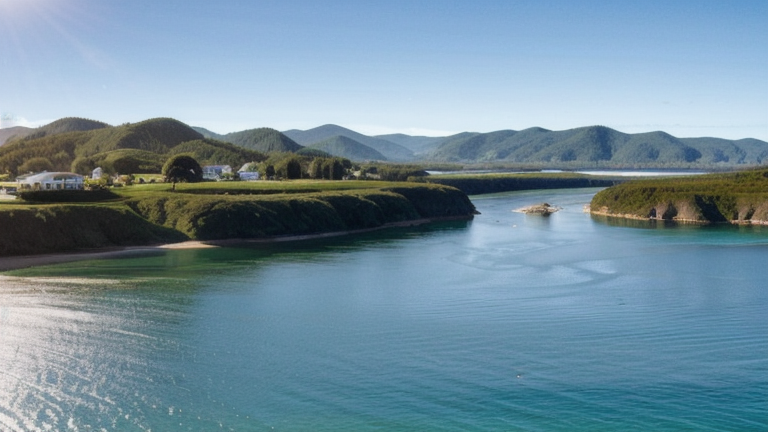
Sugar Dock, Saipan, Northern Mariana Islands
Landing Point · MP Northern Mariana Islands
Connected Cables
| Cable | Status |
|---|---|
| Atisa | Active |
📡 Live Performance
RTT measurements to this landing point from 2026-03-28 through 2026-07-22 - live ICMP round-trip time via our monitoring probes. Recomputed daily. ✓ No anomalies detected in the monitored period.
Measurement sources
| Probe | Location | Samples | Avg |
|---|---|---|---|
| #329 | control probe | 83 | 31.5 ms |
| #6427 own probe | Sydney AU | 7 | 200.8 ms |
| #6487 own probe | Singapore SG | 7 | 108.7 ms |
| #6410 own probe | Sao Paulo BR | 6 | 297.6 ms |
| #1014589 own probe | Almaty KZ | 3 | 320.7 ms |
| #7062 own probe | Cape Town ZA | 2 | 301.7 ms |
| #1014473 own probe | Minsk BY | 1 | 220.3 ms |
| #1014597 own probe | Tbilisi GE | 1 | 311.6 ms |
| #1014969 own probe | Jerusalem IL | 1 | 327.7 ms |
About Sugar Dock, Saipan, Northern Mariana Islands
Sugar Dock, Saipan: Submarine Cable Landing Point
Sugar Dock is a coastal structure located at Chalan Kanoa on the western shore of Saipan, the largest island of the Northern Mariana Islands, extending into the Philippine Sea in the western North Pacific Ocean. This site serves as a submarine cable landing point, connecting Saipan to the regional undersea cable network. One submarine cable, Atisa, lands at Sugar Dock, linking Saipan to the neighboring island of Guam and supporting inter-island connectivity within this part of the western Pacific.
The Atisa cable establishes a short but direct regional link between the Northern Mariana Islands and Guam, enabling data connectivity within a compact inter-island corridor across the western North Pacific. At 279 kilometres in length, the connection reflects the relatively modest distances between these island groups while serving an important inter-island communications function for the territory.
Cables Landing at Sugar Dock, Saipan
Atisa is a submarine cable measuring 279 kilometres in length, with a ready-for-service date of 2017 and a draft status. The cable connects Saipan in the Northern Mariana Islands with Guam, forming a direct inter-island link across the western North Pacific. Atisa represents the sole submarine cable infrastructure at the Sugar Dock landing point, providing the primary undersea connection from this location to the broader regional network accessible via Guam.
Regional Context
Within the Northern Mariana Islands, six landing points collectively host six submarine cables. Sugar Dock, Saipan ranks alongside Rota, Saipan (main), San Jose, and Sasanlagu, each of which also hosts a single cable, while Tinian stands out as the territory's most connected landing point with five cables. Sugar Dock's single-cable presence places it in the middle tier of the territory's submarine cable infrastructure by cable count.
Network Role
Sugar Dock, Saipan functions as a single-cable terminus, with the Atisa cable providing a direct inter-island submarine link to Guam. Through this connection, the landing point enables Saipan to access the broader submarine cable ecosystem that passes through Guam, one of the western Pacific's most connected cable hubs. The focus of the Sugar Dock site is therefore on short-range, inter-island regional connectivity rather than long-haul intercontinental routing.
In the broader submarine cable graph of the western Pacific, the Sugar Dock landing point represents a single-path node whose onward connectivity depends on the cables serving Guam. Its presence ensures that this part of Saipan's coastline maintains a dedicated undersea link to the regional network, situating the Northern Mariana Islands more firmly within the inter-island connectivity fabric of the western North Pacific.
What next: Sugar Dock, Saipan, Northern Mariana Islands in the global directory of cable landing points; see surrounding routes on the interactive submarine cable map or follow live network monitoring.
Other Landing Points in Northern Mariana Islands
Landing Point
- CountryMP Northern Mariana Islands
- Coordinates15.1518°N 145.6996°E
- Connected Cables1
See Real Cable Routes
View actual submarine cable routing from Sugar Dock, Saipan, Northern Mariana Islands - with backbone nodes, distance calculations, and latency estimates
Open Calculator →